Resistivity Imaging in 2D & 3D!
Click on the image for
more detailed view or information
Burnsville Quarry Gravel Mine. Data Collected
Geofyzika RS 100M
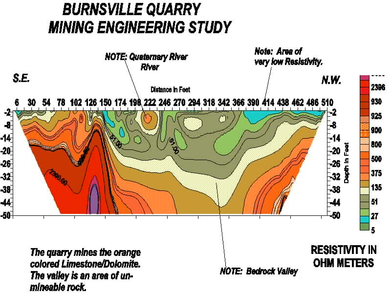
This bedrock valley which also shows a extinct quaternary river channel
is a very good section. Note how long this line is. Also note
that
it took only 5 hours to collect the data for this section.
It has some 1,100 data points.
Please click next to continue reviewing resistivity imaging case
studies
: NEXT